Total population to population density for Baltimore City, Baltimore County, and Howard CountySeptember 27, 2022 A map I created using ArcGIS for GES286. read more
Historical unemployment insurance mapsAugust 14, 2022 I created these maps in Stata while working on a history paper to discuss how UI coverage has changed across time. Light purple indicates that a state is in the middle 50% of states for weekly maxium benefit generosity and has the median maxium number of weeks. read more
Percent of homes with no AC for 35 major metro areasJuly 25, 2022 I created this map using R to write this blog on how climate change makes AC access a public health issue. read more
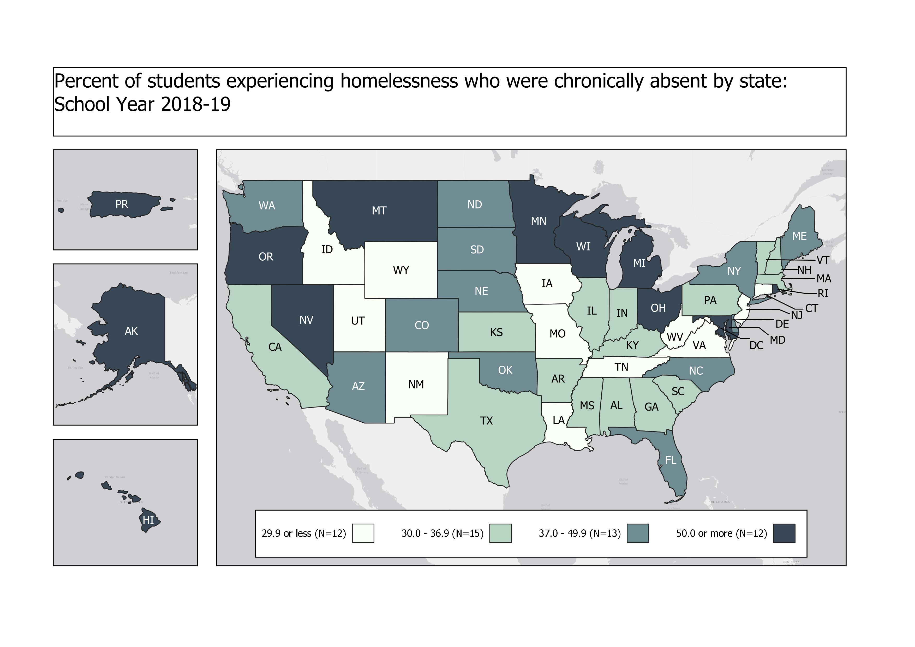
Maps for National Center for Homeless EducationFebruary 01, 2022 I made a series of these using QGIS for the National Center for Homeless Education, under the McKinney-Vento Homeless Assistance Grant. This one shows the percent of student experiencing homelessness who were also chronically absent. read more
‘The Great Question’: Slavery, Sectionalism, and the U.S. Naval Officer Corps, 1820-1861February 06, 2021 A map I created using QGIS for Dr. Roger Bailey’s disertation in which he discussed Civil War Naval Officer’s origin’s and loyalties. read more